PRECISION AGRICULTURE
Agriculture drone mapping for prairie farms
See what you cannot from the access road. Drone imagery shows crop stress, drainage problems and in-field variation, then turns it into maps you or your agronomist can act on.
How we can help
The right view for the job.
Video scouting
A fast visual overview of your land, a good first step if you are new to drone data.
Orthomosaic mapping
Map-accurate field imagery for measuring and spotting problem areas such as drainage.
NDVI and multispectral imagery
Crop health across the season, so you can compare stages and judge treatment success.
Zonation maps
Georeferenced zones from index values, ready for variable-rate fertilizer decisions.
Digital surface models
Elevation and contour data for drainage analysis and conservation planning.
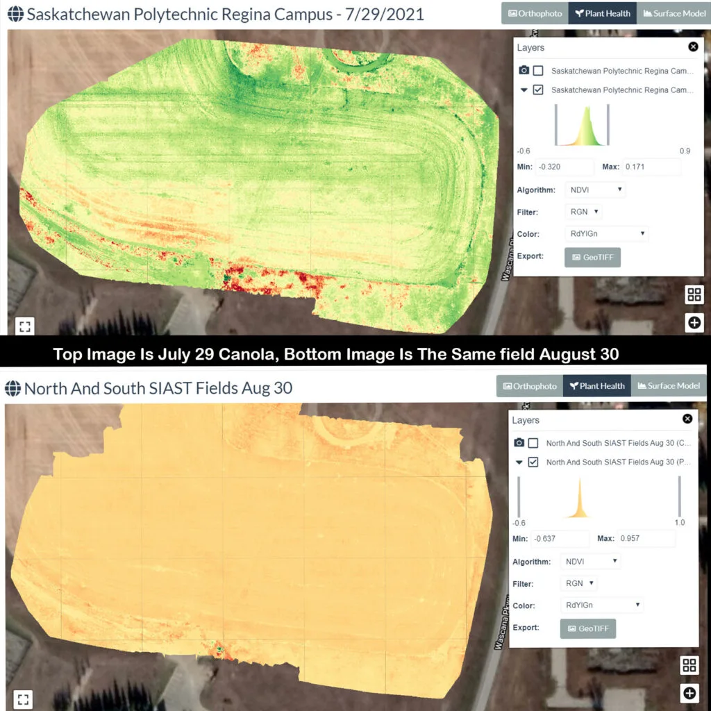
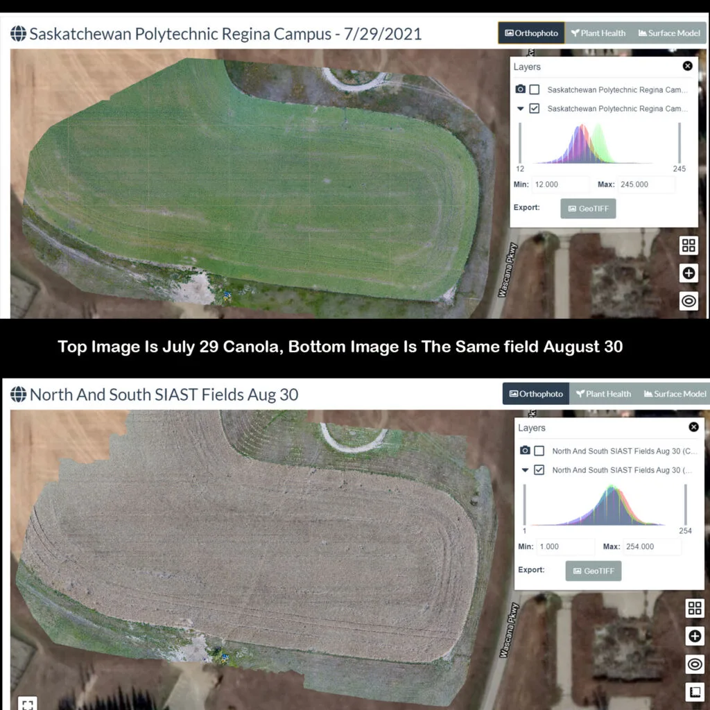
One field. Two perspectives.
Follow the season, not just a single flight.
Libitron captured this canola field near Regina in July and August. Visible imagery and NDVI maps provide complementary records of change, helping you and your agronomist compare conditions and plan the next step.
A straightforward process
From a question to a useful answer.
We start with what you need to know, then plan the flight and deliver the data to match.
Plan
Scope the job
We talk through the site, the decision you need to make and the data that answers it.
Capture
Capture
Advanced certified pilots fly to Canadian Aviation Regulations, with the right sensor for the job.
Process
Build the outputs
Imagery becomes orthomosaics, models, thermal reports or NDVI maps.
Deliver
Share it
Results land in the cloud so every contractor, adjuster or agronomist can open them.
Let's scope your project
Tell us the site.
We'll help with the next step.
Not sure which service you need? Start with the question you want answered. We will help you identify the right capture and deliverables.